Disclosure: As an Amazon Associate, HikePod earns from qualifying purchases at no extra cost to you.
⭐ Our Top Pick
🏆 Best Overall: Gaia GPS Premium — professional-grade map layers, robust offline downloads, and route planning tools that work when you're miles from cell service.
💰 Best Free Option: Maps.me — completely free offline navigation that handles established trails without subscriptions or ads cluttering your hike.
Introduction
Your phone buzzes with a "No Service" alert three miles into the trail. You pull up your maps app, only to watch it spin helplessly, searching for data that will never come. We've all been there, and it's exactly why offline maps apps exist.
But here's the real question: do you actually need one? After comparing dozens of free and premium options based on manufacturer specs and thousands of verified user reviews, we've learned that the answer depends entirely on where and how you hike. A casual day hiker on well-marked state park trails has vastly different needs than a backpacker navigating unmarked wilderness for a week.
In this guide, we break down when free offline maps apps like Maps.me and OSMAnd will serve you perfectly well, and when investing in premium tools like Gaia GPS or AllTrails Pro becomes essential for safety and peace of mind. We also cover the backup navigation tools every hiker should carry, regardless of which app they choose.
What to Look For in an Offline Maps App
Map Coverage and Detail — The app must offer downloadable topographic maps for your target region, with sufficient detail to identify trails, water sources, elevation changes, and potential hazards. Free apps often use OpenStreetMap data, which varies wildly in accuracy depending on local volunteer contributions.
Offline Functionality — True offline capability means the app can calculate routes, display your GPS position, and provide navigation cues without any cell or Wi-Fi connection. Some apps claim "offline" but only cache limited areas or require periodic online check-ins.
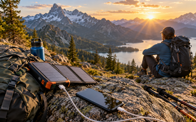
Battery Efficiency — GPS drains batteries fast. The best apps use low-power location polling and let you toggle screen brightness or airplane mode to extend runtime. Expect 6-10 hours of active navigation on a typical smartphone; carry a power bank for longer trips. If you're piecing together a full backcountry kit, our Best Solar Power Banks for Backpacking That Actually Charge 2026 guide covers real-world charging speeds.
Route Planning and Waypoints — Premium apps shine here: pre-plan multi-day routes, mark campsites and water sources, share tracks with trip partners. Free apps typically lack these features or lock them behind paywalls.
Backup Hardware Compatibility — The best digital navigation setup includes analog backup. A simple Suunto A-10 Field Compass weighs under an ounce, never runs out of batteries, and works when your phone dies. Pair it with a paper map and you have true redundancy.
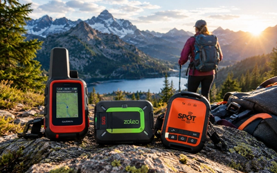
Emergency Communication Integration — No maps app can call for help when you're out of cell range. Serious backcountry hikers pair their navigation tools with a Garmin inReach Mini 2 Satellite Communicator for two-way messaging and SOS anywhere on Earth. Our Best Satellite Messengers for Hiking Without Cell Service 2026 guide compares the top options.
💡 Pro Tip: Download maps over Wi-Fi before you leave home. Cellular data in mountain towns is often slow and metered, and you don't want to burn through your phone's battery downloading gigabytes of tiles in a parking lot.
When Free Apps Are Enough
For most day hikers on established trails, free offline maps apps handle navigation perfectly well. If you're hitting popular state or national parks with well-marked paths, strong trail infrastructure, and plenty of other hikers around, apps like Maps.me, OSMAnd, or even Google Maps offline (limited to basic roads and major trails) will get you there and back.
Maps.me (Free)
| Criteria | Score |
|----------|-------|
| Trail Coverage | 7/10 |
| Offline Reliability | 9/10 |
| Battery Efficiency | 8/10 |
| Feature Depth | 5/10 |
Maps.me is the workhorse of free offline navigation. Built on OpenStreetMap data, it covers the entire globe and works completely offline once you've downloaded the regional maps (usually 50-300 MB per state or country). The interface is clean, GPS tracking is accurate, and battery drain is modest compared to feature-heavy competitors.
Where Maps.me falls short is trail detail in remote areas. OpenStreetMap relies on volunteer contributions, so while major trails in popular parks are well-documented, obscure routes or newly opened wilderness areas may be missing or outdated. There's no route planning beyond basic point-to-point navigation, and you can't import GPX tracks or share routes with friends.
✅ Pros:
- Completely free with no subscription
- Works entirely offline once maps downloaded
- Low battery drain
- Covers international destinations well
❌ Cons:
- Trail coverage spotty in remote areas
- No route planning or advanced features
- Ads in free version (though unobtrusive)
- Limited topographic detail
Free apps excel for casual hikers, international travelers who need navigation in unfamiliar cities and countryside, and anyone building familiarity with digital navigation before committing to a paid subscription. They're also perfect as a backup to premium apps—download both, and you have redundancy if one fails.
When Premium Apps Are Worth It
Once you venture into unmarked backcountry, plan multi-day trips, or navigate complex terrain where a wrong turn could mean hours of backtracking, premium apps justify their cost through superior map layers, robust offline storage, and professional-grade tools.
Gaia GPS Premium ($39.99/year)
| Criteria | Score |
|----------|-------|
| Map Layer Selection | 10/10 |
| Offline Storage | 9/10 |
| Route Planning | 9/10 |
| Ease of Use | 7/10 |
Gaia GPS is the gold standard for serious backcountry navigation. The Premium subscription unlocks access to dozens of map layers—National Geographic trails, USGS topographic quads, weather overlays, satellite imagery, and specialty layers for skiing, climbing, and overlanding. You can download up to 500 MB of offline maps per area (upgradable to unlimited with higher tiers), and the route planning tools include elevation profiles, distance markers, and waypoint notes.
The learning curve is steeper than casual apps, but the depth rewards investment. Gaia integrates with desktop trip planning, syncs across devices, and lets you share tracks with trip partners in real time. Battery life is acceptable (6-8 hours of active navigation) with proper power management.
✅ Pros:
- Massive selection of map layers including NatGeo and USGS
- Offline area downloads up to 500 MB per map
- Route planning with elevation profiles
- Desktop integration for detailed trip planning
❌ Cons:
- Subscription required for best features
- Can drain battery faster than simpler apps
- Interface overwhelming for beginners
AllTrails Pro ($35.99/year)
| Criteria | Score |
|----------|-------|
| Trail Database | 10/10 |
| User Reviews | 9/10 |
| Offline Maps | 8/10 |
| Advanced Features | 6/10 |
AllTrails Pro strikes the balance between ease of use and functionality. Its killer feature is the massive, crowdsourced trail database with verified reviews, photos, and recent condition updates. The Pro subscription adds offline map downloads, weather forecasts, and the ability to print maps—ideal for hikers who want simplicity without sacrificing core offline capability.
Route planning is straightforward but less robust than Gaia. You can record your hike, mark waypoints, and share tracks, but there's less granular control over map layers and advanced navigation features. The topographic detail is adequate for most trails but lacks the depth professionals need for complex terrain.
✅ Pros:
- Huge trail database with verified reviews
- Simple interface for casual hikers
- Offline maps included with Pro subscription
- Recent trail condition updates from community
❌ Cons:
- Limited topographic detail compared to Gaia
- Route planning tools less robust for complex trips
- Subscription required for offline access
Avenza Maps (Free App + Paid Maps)
| Criteria | Score |
|----------|-------|
| Map Accuracy | 10/10 |
| Offline Reliability | 9/10 |
| Cost Efficiency | 7/10 |
| User Interface | 6/10 |
Avenza takes a different approach: the app is free, but you purchase individual georeferenced maps (typically $0-$15 each). Many official park service and USGS maps are available, giving you the exact same cartography rangers use. GPS tracking works flawlessly offline, and you can import custom PDFs if you have georeferenced maps from other sources.
The downside is the pay-per-map model adds up if you explore multiple regions, and the interface feels dated compared to Gaia or AllTrails. But for purists who want government-grade accuracy and don't mind the per-region cost, Avenza is unbeatable.
✅ Pros:
- Uses official USGS and park service maps
- GPS works without cell service
- Can import custom georeferenced PDFs
- Free app with no subscription
❌ Cons:
- Must purchase individual maps for many areas
- Interface less intuitive than competitors
- Costs add up for frequent travelers
💡 Pro Tip: Test your offline maps setup on a short, familiar trail before committing to a backcountry trip. Confirm GPS accuracy, practice waypoint marking, and verify battery drain under real hiking conditions.
The Role of Dedicated GPS Devices
Smartphones have replaced dedicated GPS units for many hikers, but handheld devices still have a place. The Garmin eTrex 22x Handheld GPS offers 25-hour battery life, rugged waterproof construction, and preloaded TopoActive maps that work anywhere without subscriptions. For multi-day trips where charging opportunities are scarce, or environments where dropping your phone means disaster (whitewater, alpine climbing), a dedicated GPS provides peace of mind.
The tradeoff is cost, weight, and a clunkier interface. Most weekend hikers are better served by a phone app plus a backup power bank and compass. But if you're regularly pushing into true wilderness or need navigation tools that survive submersion and hard falls, a handheld GPS is worth considering.
Analog Backup: The Non-Negotiable Safety Layer
No matter which digital navigation tool you choose, always carry analog backup. A paper topographic map and compass weigh a few ounces, never run out of batteries, and work in any weather. The Suunto A-10 Field Compass is our go-to: liquid-filled for stable readings, clear baseplate for map work, and costs less than twenty bucks.
Learn basic map-and-compass skills before you need them. Practice taking bearings, triangulating your position, and following a compass course in familiar terrain. When your phone dies three miles from the trailhead in a rainstorm, these skills are the difference between a minor inconvenience and a genuine emergency.
Frequently Asked Questions
Can I use offline maps apps without any cell service at all?
Yes, as long as you download the maps before you lose signal. GPS satellites broadcast location data independently of cellular networks, so your phone can still pinpoint your position and display it on downloaded maps. The only features that require connectivity are live weather updates, trail condition reports, and sharing your location with others.
How much phone storage do offline maps consume?
It varies widely. A single state's worth of basic road maps might be 100-200 MB, while high-resolution topographic maps with satellite imagery can reach 500 MB to several gigabytes for large wilderness areas. Most apps let you select download quality and region size to balance detail with storage constraints.
Do offline maps drain my battery faster than regular apps?
GPS navigation does consume more battery than typical phone use, but offline maps are actually more efficient than streaming maps because they eliminate constant data requests. Expect 6-10 hours of active navigation on a modern smartphone with the screen on. Enable airplane mode, reduce screen brightness, and close background apps to maximize runtime. Carry a power bank for trips longer than a day—and don't forget the essentials like a Sawyer Squeeze Water Filter System, the one piece of gear every hiker should carry regardless of navigation method.
Can I share my location with friends or family while hiking offline?
Not in real time without cell service or satellite connectivity. Some premium apps let you pre-share your planned route so others can see your intended path, but live tracking requires either cellular data or a satellite communicator. The Garmin inReach Mini 2 enables real-time location sharing and two-way messaging anywhere on Earth via the Iridium satellite network, making it invaluable for remote trips where you want to stay connected.
Are free offline maps accurate enough for backcountry hiking?
It depends on the region and how recently the maps were updated. Free apps using OpenStreetMap data are excellent for popular trails in well-traveled areas, but coverage degrades in remote wilderness where fewer volunteers contribute. Premium apps source data from government agencies (USGS, NatGeo) and professional cartographers, offering higher reliability in unmarked backcountry. Always cross-reference your digital maps with current park service information and carry paper backups.
Final Thoughts
The right offline maps app depends on your hiking style, destination, and risk tolerance. For casual day hikers on established trails, free apps like Maps.me provide reliable navigation without recurring costs. Once you venture into remote backcountry, plan complex multi-day routes, or need professional-grade topographic detail, premium subscriptions like Gaia GPS or AllTrails Pro deliver value through superior map layers, robust offline storage, and safety-critical route planning tools.
Regardless of which app you choose, never rely solely on digital navigation. Carry a paper map, compass, and backup power. Learn basic orienteering skills. Tell someone your route and expected return time. Technology enhances wilderness travel, but fundamental preparedness keeps you safe when screens go dark.
Download your maps, test your setup on familiar terrain, and head out with confidence knowing you have the tools to navigate whatever the trail throws at you.
Editor's Choice
Garmin inReach Mini 2 Satellite Communicator — When hiking beyond cell range, this device provides two-way messaging, SOS alerts, and real-time location sharing via satellite, making it essential safety gear for serious backcountry trips.
Suunto A-10 Field Compass — Every hiker needs analog backup navigation, and this classic liquid-filled compass delivers reliable bearings without batteries for under twenty bucks.
Garmin eTrex 22x Handheld GPS — For multi-day trips where phone battery life becomes a concern, this rugged handheld GPS offers 25 hours of runtime and preloaded TopoActive maps that work anywhere without subscriptions.