Disclosure: As an Amazon Associate, HikePod earns from qualifying purchases at no extra cost to you.
⭐ Our Top Pick
🏆 Best Overall: Garmin eTrex 22x Handheld GPS — preloaded topo maps and 25-hour battery make it the ideal tool for marking, logging, and navigating back to every track site you find.
💰 Best Value: Sawyer Squeeze Water Filter System — at under $30 and 3 oz, it's the lightest safety upgrade for anyone following wildlife sign to remote water sources.
Introduction
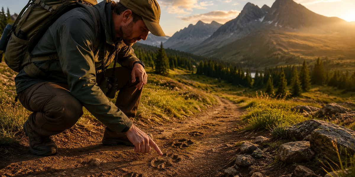
The trail is never as empty as it looks. Long after the deer, bobcat, or black bear has vanished into the trees, it leaves behind a language written in mud, snow, sand, and bark — a language every hiker can learn to read. Tracking is one of the oldest human skills on Earth, and picking it up will transform an ordinary walk in the woods into something closer to detective work.
We've spent seasons hiking with wildlife biologists, tracker instructors, and wilderness guides across North America, and we're bringing that experience straight to you in this 2026 field guide. Whether you've never noticed a footprint before or you're already identifying gait patterns, this guide will sharpen your eye and deepen your connection to the landscape around you.
By the end of this article you'll know how to identify common mammal tracks by shape and size, interpret scat, rubs, scratches, and beds, understand travel patterns, and carry the right gear to make every outing safer and more productive.
What to Look For
Before you drop to one knee in the mud, train your brain to ask the right questions.
- Track Shape and Toe Count — Canines (dogs, coyotes, wolves) show 4 toes with claw marks in a roughly oval print. Felines (bobcat, mountain lion) also show 4 toes but with a wider, rounder shape and no claw marks — cats retract their claws. Raccoons and opossums leave distinctive 5-fingered prints that look almost human.
- Track Size — Carry a small ruler or use a coin for scale photos. A front track wider than 4 inches in cougar country deserves serious attention. Black bear front feet run 4–6 inches wide; grizzly front feet often exceed 5 inches with a more squared heel.
- Gait Pattern — Look at the whole trail, not just one print. Diagonal walkers (deer, elk, dogs) alternate left-right in a neat line. Bounders (weasels, mink) land their back feet in or near their front footprints. Loping animals (rabbits, squirrels) show a distinctive paired-front, paired-back cluster.
- Substrate and Freshness — Fresh tracks in wet mud show crisp edges and may still hold water. Tracks dried by sun or wind lose detail rapidly. Snow tracks expand as they age; a large-looking print may be a small animal whose track has melted outward.
- Associated Sign — Tracks rarely travel alone. Look for nearby scat, hair on branches, claw marks on trees, wallows, scrapes, and browse lines on vegetation.
- Travel Direction and Purpose — Is the animal moving in a straight, purposeful line (traveling) or weaving and circling (foraging)? A sudden sprint pattern suggests a predator-prey encounter happened right here.
Field Gear for Wildlife Trackers
Garmin eTrex 22x Handheld GPS
| Criteria | Score |
|----------|-------|
| Map Detail | 9/10 |
| Battery Life | 9/10 |
| Durability | 8/10 |
| Value for Money | 7/10 |
When you find a compelling track site — say, a muddy creek crossing with fresh bear and mountain lion prints overlapping — you want to be able to mark that waypoint precisely and navigate back to it at first light tomorrow when the sign is freshest. The Garmin eTrex 22x does exactly that with preloaded TopoActive maps so you always know whether you're in a drainage, on a ridge, or near a water source that explains the animal activity. Its 25-hour battery outlasts any day hike or overnight, and the rugged waterproof body survives the creek crossings where the best tracks hide.
💡 Pro Tip: Create a dedicated waypoint category called "TRACKS" on your GPS. Over a full season you'll build a personal map of local wildlife corridors that no published guide can match.
✅ Pros:
- TopoActive maps provide instant terrain and watershed context
- 25-hour battery handles multi-day expeditions
- Rugged IPX7 waterproof construction
❌ Cons:
- Small display can be limiting for detailed map review
- No satellite messaging built in — add an inReach for remote safety
---
Garmin inReach Mini 2 Satellite Communicator
| Criteria | Score |
|----------|-------|
| Coverage | 10/10 |
| SOS Reliability | 10/10 |
| Size & Weight | 9/10 |
| Cost of Ownership | 6/10 |
Following animal sign has a habit of pulling you off marked trails and into terrain where cell service is a distant memory. The Garmin inReach Mini 2 pairs seamlessly with the eTrex 22x and gives you two-way satellite messaging plus a one-button SOS linked to the GEOS global rescue coordination center. If a tracking session takes you into a remote canyon at dusk and something goes wrong, this device is the difference between a close call and a tragedy.
✅ Pros:
- True global satellite coverage via Iridium network
- Lightweight enough to forget it's on your pack strap
- Tracks your route for sharing with trip partners
❌ Cons:
- Monthly subscription is an ongoing cost
- Premium price point may deter casual day hikers
---
Sawyer Squeeze Water Filter System
| Criteria | Score |
|----------|-------|
| Filtration Level | 9/10 |
| Weight | 10/10 |
| Flow Rate | 8/10 |
| Value | 10/10 |
Animal activity concentrates around water — stream crossings, seeps, pond edges, and wallows. These are the richest tracking spots on any landscape, and they're also where waterborne pathogens thrive. The Sawyer Squeeze filters to 0.1 micron and weighs just 3 oz, meaning you can drink directly from the same creek the beaver just swam through without a second thought. Never skip a productive tracking site because you're out of water.
✅ Pros:
- Filters bacteria and protozoa to 0.1 micron
- Ultralight and packable — attaches to any standard water bottle
- Lifetime warranty with simple backflush maintenance
❌ Cons:
- Does not filter viruses (standard risk level in North American backcountry is low)
- Flow rate degrades without regular backflushing
Frequently Asked Questions
How do I tell a dog track from a coyote track?
Both show 4 toes and claws, but shape and placement differ. Coyote tracks are narrower and more oval, with toes that tend to group tightly together forming an X-shape in the negative space. Domestic dog tracks are rounder and the toes splay wider. Coyote gaits are also more efficient — their prints often fall in a nearly straight line, while dogs tend to wander.
What's the best substrate for finding tracks?
Wet mud near water edges is ideal — it captures the finest detail. Soft snow (not crusty or granular) is excellent. Dry dust on unpaved roads is underrated and often shows perfect prints. Sandy streambeds and ocean-adjacent trails are also productive.
Is it safe to approach areas with large predator sign?
Exercise standard bear and mountain lion awareness protocols. Fresh large cat or bear sign means the animal may be nearby. Make noise, hike in groups when possible, and carry bear spray in appropriate habitat. Tracking is about observation from a respectful distance — never follow fresh sign directly toward a potential den or bedding area.
Do I need special books or apps to identify tracks?
A quality field guide like Mammal Tracks & Sign by Mark Elbroch is the gold standard and worth the investment. Apps like iNaturalist can assist with photo-based ID and contribute your observations to citizen science databases — a meaningful bonus.
What time of year is best for tracking?
Winter and early spring offer the best conditions in most of North America. Snow preserves tracks beautifully, animals are more active at dawn and dusk, and deciduous vegetation is stripped back so you can see travel corridors clearly. Mud season immediately after snowmelt is a close second.
Final Thoughts
Learning to read animal tracks and signs is a skill that compounds over time. Every trail session adds to a mental library of shapes, patterns, and behaviors that eventually lets you reconstruct an entire story from a few square feet of soft ground. You'll start noticing things you walked past a hundred times before — the claw rake on a birch trunk, the five-toed shuffle in the streambank mud, the pile of acorn husks that tells you a squirrel sat in that exact branch.
Kit yourself out thoughtfully, take a notebook, photograph everything with something for scale, and above all slow down. The trail rewards patience. Start this season, and by 2027 you'll be the one pointing out the mountain lion scrape that everyone else missed entirely.
Editor's Choice
Garmin eTrex 22x Handheld GPS — lets you waypoint every compelling track site on a topo map so you can build a season-long picture of local wildlife movement corridors.
Garmin inReach Mini 2 Satellite Communicator — essential for any tracker who follows sign into roadless backcountry beyond cell coverage.
Sawyer Squeeze Water Filter System — because the richest tracking spots are always near water, and you need to be able to drink safely wherever the animals lead you.