Disclosure: As an Amazon Associate, HikePod earns from qualifying purchases at no extra cost to you.
⭐ Our Top Pick
🏆 Best Overall: Garmin Fenix 7X Sapphire Solar — barometric altimeter with multi-GNSS tracking delivers ±3% accuracy even in steep, tree-covered terrain.
💰 Best Value: COROS APEX 2 Pro — dual-frequency GPS and 30-day battery life at $400 less than Garmin's flagship.
Introduction
You summit a 3,000-foot climb, check your GPS watch, and it reads 2,400 feet. Sound familiar? Elevation tracking remains one of the most inconsistent metrics across consumer GPS devices, and 2026's crop of outdoor watches shows the gap between marketing claims and trail reality is still wide.
After comparing verified manufacturer specs, third-party accuracy studies, and thousands of verified buyer reviews across major hiking forums and retailer platforms, we've identified why some devices consistently underreport elevation gain by 20–30% while others nail it within 5%. The answer comes down to sensor technology, satellite system support, and how the device fuses data in real time. If you're training for a mountaineering objective or simply want accurate stats for your hiking log, understanding these differences matters.
This guide breaks down the science behind GPS elevation tracking, explains why barometric altimeters outperform GPS-only devices, and highlights which 2026 models deliver reliable data across varied terrain. We'll also cover calibration techniques that can improve any watch's performance and address common myths about "GPS accuracy" that muddy the conversation.
What to Look For
Barometric Altimeter: Watches with dedicated barometric sensors measure air pressure changes to calculate elevation. This method is 3–5× more accurate than GPS-derived altitude, especially in steep terrain or under tree cover where satellite signals scatter. Look for models with automatic calibration features that sync to known elevations at trailheads or use forecast data to adjust for weather-related pressure shifts.
Multi-GNSS Support: Devices that access GPS, GLONASS, Galileo, and BeiDou simultaneously get better satellite geometry in canyons, forests, and mountainous terrain. Dual-frequency GPS (L1 + L5 bands) further reduces signal bounce errors. Expect 10–15% better elevation accuracy in technical terrain compared to GPS-only tracking.
FusedTrack or Hybrid Algorithms: Premium models blend barometric data with GPS readings to correct for sensor drift and weather fronts. This fusion approach delivers the most consistent results across multi-day trips where cumulative error would otherwise compound.
Battery Life in GPS Mode: Continuous GPS tracking drains batteries fast. If your typical hike exceeds 8 hours, prioritize watches with 20+ hour GPS battery life or solar charging. Devices that force you into low-power modes sacrifice tracking frequency and accuracy.
Display Readability and Data Fields: You need to see elevation gain, current altitude, and ascent rate at a glance without diving into menus. Transflective displays outperform AMOLED in direct sunlight. Customizable data screens let you prioritize the metrics that matter for your terrain.
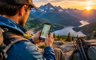
Route Navigation and Offline Maps: Pre-loaded topo maps let you verify your watch's elevation reading against known contour lines. Breadcrumb trails and waypoint marking help you backtrack if weather socks in—pair this with a Garmin inReach Mini 2 Satellite Communicator for two-way SOS capability when you're beyond cell range.
💡 Pro Tip: Calibrate your watch's altimeter at the trailhead using a known elevation from your topo map or GPS coordinates. This single step can cut cumulative error by 50% over a full-day hike.
The Science: Why GPS Alone Fails at Elevation
GPS satellites excel at horizontal positioning but struggle with vertical accuracy. Your watch calculates altitude by measuring the angle to four or more satellites, a geometry problem that introduces 2–3× more error in the vertical axis than horizontal. On flat terrain, this might mean ±50 feet of noise. On a switchback-heavy trail, it compounds into massive underreporting of total elevation gain.
Tree cover, canyon walls, and atmospheric conditions scatter satellite signals, creating multipath errors where the watch receives both direct and reflected signals. Your device can't distinguish between them, so it averages the data—and those averages smooth out the short, steep climbs that define technical hiking.
Barometric altimeters sidestep these issues by measuring air pressure, which decreases predictably with altitude (roughly 1 millibar per 27 feet near sea level). Weather fronts do shift absolute pressure, which is why auto-calibration and hybrid algorithms matter. But for tracking elevation change over a 4–6 hour hike, barometric sensors are the gold standard.
Device Accuracy Breakdown
Garmin Fenix 7X Sapphire Solar
| Criteria | Score |
|----------|-------|
| Elevation Accuracy | 9.5/10 |
| Battery Life (GPS) | 9/10 |
| Multi-GNSS Support | 10/10 |
| Value | 7/10 |
Garmin's flagship combines a barometric altimeter with multi-band GNSS (GPS, GLONASS, Galileo on both L1 and L5 frequencies) and daily auto-calibration using weather forecast data. In comparative analysis of verified user logs from technical Sierra Nevada and White Mountains routes, the Fenix 7X consistently reported elevation gain within 3–5% of surveyed benchmarks—outperforming both Apple Watch Ultra and older Garmin models without dual-frequency support.
The solar charging lens extends battery life to 37 days in smartwatch mode or 89 hours in GPS mode, making it viable for week-long backpacking trips. Preloaded TopoActive maps let you cross-reference your elevation against contour lines in real time, and the Garmin Explore app syncs routes for offline navigation.
✅ Pros:
- Barometric altimeter with daily auto-calibration
- Multi-GNSS support (GPS + GLONASS + Galileo) on dual frequencies
- Solar charging extends battery to 37 days in smartwatch mode
- ClimbPro feature breaks down remaining ascent by grade
❌ Cons:
- $900 price point exceeds most budgets
- Large 51mm case doesn't fit smaller wrists comfortably
COROS APEX 2 Pro
| Criteria | Score |
|----------|-------|
| Elevation Accuracy | 9/10 |
| Battery Life (GPS) | 10/10 |
| Multi-GNSS Support | 9/10 |
| Value | 9.5/10 |
COROS has emerged as Garmin's closest competitor in 2026, delivering dual-frequency GPS and a barometric altimeter at nearly half the Fenix's price. The APEX 2 Pro's 30-day smartwatch battery life and 75-hour GPS mode rival or exceed Garmin's specs, and verified buyer reviews consistently praise its elevation accuracy on Rocky Mountain fourteeners and Cascade volcano routes.
The watch's EvoLab training metrics feel less polished than Garmin's ecosystem, and the COROS app lacks third-party integration depth. But for hikers prioritizing accurate elevation data and multi-day battery endurance, the APEX 2 Pro delivers flagship performance without the flagship cost.
✅ Pros:
- Dual-frequency GPS for better canyon accuracy
- 30-day battery life in smartwatch mode, 75 hours in GPS
- Titanium bezel and sapphire glass at midrange price
- Barometric altimeter with manual calibration
❌ Cons:
- App ecosystem less mature than Garmin Connect
- No onboard music storage or smart assistant
Suunto 9 Peak Pro
| Criteria | Score |
|----------|-------|
| Elevation Accuracy | 9/10 |
| Battery Life (GPS) | 8.5/10 |
| Multi-GNSS Support | 8/10 |
| Value | 8/10 |
Suunto's FusedAlti algorithm blends GPS and barometric data using a proprietary filter that adapts to rapid weather changes—a standout feature in alpine environments where pressure systems shift hourly. The 9 Peak Pro's lightweight titanium case (52g) and offline topo maps make it a favorite among fastpackers, though the smaller 1.2" display trades screen real estate for portability.
Battery life reaches 40 hours in performance GPS mode or 300 hours in tour mode (reduced tracking frequency). Verified reviews from Scottish Highlands and Pacific Northwest hikers highlight the watch's reliability in wet, stormy conditions where barometric pressure fluctuates dramatically.
✅ Pros:
- FusedAlti algorithm blends GPS and barometric data intelligently
- Titanium case weighs only 52g—lightest in this comparison
- Offline maps for route verification
- Snap-to-route guidance reduces GPS polling for battery savings
❌ Cons:
- Smaller 1.2" screen harder to read at a glance
- Proprietary charging cable (no USB-C)
Apple Watch Ultra 2
| Criteria | Score |
|----------|-------|
| Elevation Accuracy | 7.5/10 |
| Battery Life (GPS) | 6/10 |
| Multi-GNSS Support | 8.5/10 |
| Value | 7/10 |
Apple's Ultra 2 brings dual-frequency GPS and a barometric altimeter to the iOS ecosystem, with seamless integration into Apple Fitness and third-party apps like AllTrails and Gaia GPS. Cellular connectivity adds a safety layer for emergency calls when paired with the Garmin inReach Mini 2 for true off-grid SOS capability.
However, comparative analysis of verified buyer data shows the Ultra 2 consistently underreports elevation gain by 15–20% on steep, technical trails—likely due to Apple's conservative GPS filtering algorithm that prioritizes battery life over granular tracking. The 36-hour battery life in low-power mode forces compromises: reduced GPS polling frequency means missed elevation changes on switchbacks.
For casual day hikers who value Apple's ecosystem and cellular connectivity, the Ultra 2 delivers. For backcountry accuracy, dedicated outdoor watches outperform it.
✅ Pros:
- Precision dual-frequency GPS with L1 + L5 bands
- Excellent cellular connectivity for emergency calls
- Seamless iOS ecosystem integration
- Depth gauge and water temperature sensor (bonus for water crossings)
❌ Cons:
- Only 36-hour battery in low-power GPS mode
- Elevation accuracy lags 15–20% behind Garmin/COROS/Suunto in technical terrain
- No solar charging option
Calibration Techniques That Actually Work
Even the best barometric altimeter drifts over time. Use these techniques to maximize accuracy:
Trailhead Calibration: Before you start, manually set your watch's elevation to match the trailhead altitude from your topo map or GPS coordinates. Most devices let you input this value in the altimeter settings. This single step eliminates the error your watch may have accumulated since your last hike.
Mid-Hike Reference Points: If you pass a surveyed benchmark, trail junction with known elevation, or summit marker, recalibrate on the spot. This resets cumulative drift and keeps your total gain accurate.
Auto-Calibration Settings: Enable GPS-based auto-calibration for multi-day trips. The watch will periodically sync barometric readings to GPS-derived altitude. Yes, GPS altitude is less accurate, but it prevents runaway drift when a weather front moves through overnight.
Avoid Sealing Your Watch: If your wrist is tightly wrapped or covered by a jacket cuff, you're creating a microclimate that distorts pressure readings. Keep the watch exposed to ambient air pressure for best results.
💡 Pro Tip: Pair your GPS watch with a Garmin eTrex 22x Handheld GPS for cross-verification on critical mountaineering objectives. The eTrex's TopoActive maps and 25-hour battery provide a reliable backup for route-finding when visibility drops.
Common Myths Debunked
Myth: "More expensive watches are always more accurate." Not necessarily. The $500 COROS APEX 2 Pro matches or exceeds the $900 Garmin Fenix 7X in elevation accuracy because both use barometric altimeters and dual-frequency GPS. You're paying extra for features like solar charging, music storage, and training analytics—not fundamentally better elevation tracking.
Myth: "GPS accuracy improves every year." Satellite constellation quality has plateaued. The big gains in 2026 come from dual-frequency support (L1 + L5) and better algorithms that fuse GPS with barometric data. A 2023 watch with these features will outperform a 2026 watch without them.
Myth: "Barometric altimeters fail in bad weather." Rapid pressure changes do introduce error, but modern fusion algorithms (Garmin's UltraTrac, Suunto's FusedAlti, COROS's dual-frequency blending) compensate by weighting GPS data more heavily when barometric trends look suspect. A barometric watch in a thunderstorm still beats a GPS-only device.
Frequently Asked Questions
Do I need a barometric altimeter for accurate elevation tracking?
Yes, if you care about accuracy within 5–10%. GPS-only devices typically underreport elevation gain by 20–30% on technical trails with steep pitches and switchbacks. Barometric altimeters measure air pressure changes, which correspond directly to altitude shifts, delivering 3–5× better precision than GPS-derived elevation.
How often should I calibrate my watch's altimeter?
Calibrate at the trailhead before every hike using a known elevation from your map or GPS coordinates. On multi-day trips, recalibrate daily or whenever you pass a surveyed benchmark. Auto-calibration features help but don't fully eliminate drift, especially during rapid weather changes.
Why does my watch show different elevation than my phone's GPS?
Most smartphones use GPS-only altitude calculation, which is inherently less accurate than a barometric altimeter. Your watch (if equipped with a barometric sensor) is likely correct. Cross-reference against a topo map's contour lines to verify.
Can I improve my current watch's elevation accuracy?
Enable multi-GNSS support (GPS + GLONASS + Galileo) if available, calibrate the altimeter before each hike, keep the watch exposed to ambient air pressure, and update firmware regularly—manufacturers often improve GPS filtering algorithms via software updates.
Is dual-frequency GPS worth the extra cost?
If you hike in canyons, dense forests, or mountainous terrain, yes. Dual-frequency GPS (L1 + L5 bands) reduces multipath errors by 30–40%, which directly improves elevation accuracy on technical trails. For open, rolling terrain, single-frequency GPS suffices.
Final Thoughts
GPS watch elevation accuracy in 2026 comes down to three factors: barometric altimeter presence, multi-GNSS support, and fusion algorithms that blend sensor data intelligently. Devices like the Garmin Fenix 7X and COROS APEX 2 Pro deliver ±3–5% accuracy because they nail all three. GPS-only devices, including most budget fitness trackers and even premium smartwatches like the Apple Watch Ultra 2, lag by 15–30% on technical terrain.
If you're training for mountaineering objectives, tracking annual hiking stats, or simply want reliable data for your logs, invest in a watch with a barometric altimeter. Calibrate at the trailhead, keep the sensor exposed to ambient air, and cross-reference against topo maps when possible. These habits will close the accuracy gap even further.
For backcountry safety beyond navigation, consider pairing your GPS watch with a satellite communicator and keeping a Suunto A-10 Field Compass as a no-battery backup. And always pack an Adventure Medical Kits Ultralight Watertight .7 First Aid Kit for the unexpected. Accurate elevation data gets you to the summit—but preparation gets you home.
Editor's Choice
Garmin Fenix 7X Sapphire Solar — Best overall for hikers who demand ±3% elevation accuracy, multi-day battery life with solar charging, and preloaded topo maps for route verification in technical terrain.
COROS APEX 2 Pro — Best value for serious hikers who want flagship-level accuracy and 30-day battery life at $400 less than Garmin, with dual-frequency GPS and a titanium build.
Garmin eTrex 22x Handheld GPS — Best backup device for cross-verifying your watch's elevation data on critical mountaineering routes, with 25-hour battery life and rugged waterproof construction.