Disclosure: As an Amazon Associate, HikePod earns from qualifying purchases at no extra cost to you.
⭐ Our Top Pick
🏆 Best Overall: Garmin inReach Mini 2 — combines GPS navigation with two-way satellite messaging and SOS for ultimate backcountry safety.
💰 Best Value: Suunto A-10 Field Compass — the $20 backup that works everywhere, forever, with zero batteries required.
Introduction
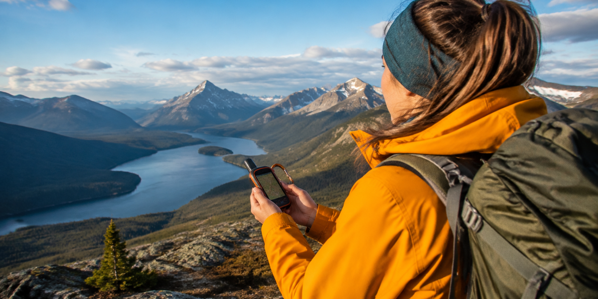
Here's the short answer: No, you absolutely do not need cell service for GPS to work while hiking. GPS receivers—whether in your smartphone, handheld unit, or watch—communicate directly with satellites orbiting 12,500 miles above Earth. Those satellites don't care about cell towers, and your device doesn't need cellular data to calculate your position.
The confusion arises because most people first encounter GPS through smartphone map apps like Google Maps, which do require data to download map tiles and search for destinations. But GPS positioning itself? That's a completely separate system that operates independently of cellular networks. Understanding this distinction is critical for backcountry safety and choosing the right navigation tools.
We've compared dozens of navigation solutions—from free smartphone apps to dedicated satellite communicators—to clarify how offline GPS actually works, which tools serve different hiking scenarios, and what backup systems you should always carry. Whether you're day-hiking local trails or embarking on a week-long wilderness trek, this guide will help you navigate confidently beyond cell coverage.
What to Look For
Offline Map Storage: Your GPS app or device must allow you to download detailed topographic maps for your hiking region before leaving home. Satellite positioning tells you where you are; stored maps tell you what's around you. Verify the app supports true offline mode, not just cached tiles that expire.
Battery Management Strategy: GPS is power-hungry. Airplane mode preserves battery by disabling cellular radio while keeping GPS active. Dedicated GPS units typically run 15–25 hours on AA batteries; smartphones drain faster. Calculate your trip duration and bring backup power or spare batteries accordingly.
Coordinate System Compatibility: Your device should display coordinates in formats that match your paper maps—typically latitude/longitude in degrees or UTM grid. This becomes critical if you need to communicate your position to search-and-rescue teams or navigate with a compass as backup.
Weather Resistance Rating: Backcountry weather changes fast. Look for IPX7 waterproof ratings minimum (survives 30 minutes underwater at 1 meter depth). Smartphones need protective cases; dedicated GPS units are typically ruggedized from the factory.
Track Recording and Waypoint Features: The ability to mark waypoints (campsites, water sources, trail junctions) and record your track helps you retrace your route if needed. Review these features before your trip—fumbling with unfamiliar menus on a foggy ridgeline is no fun.
Emergency Communication Integration: GPS tells you where you are but doesn't call for help. Satellite communicators like the Garmin inReach Mini 2 pair GPS positioning with two-way messaging and SOS capability that works anywhere on Earth—no cell towers required.
How GPS Actually Works Without Cell Service
GPS (Global Positioning System) is a constellation of 31 satellites maintained by the U.S. Space Force. Each satellite continuously broadcasts its position and precise time. Your GPS receiver listens to signals from at least four satellites simultaneously, measures the tiny time delays as those signals travel at the speed of light, and calculates your position through trilateration—essentially drawing intersecting spheres from each satellite until they pinpoint your location.
This entire process happens locally on your device. The satellites are one-way transmitters; they don't receive anything from you, and they certainly don't route through cell towers. Your phone or GPS unit is purely a passive listener doing the math internally.
The "cell service" confusion stems from A-GPS (Assisted GPS), a feature smartphones use to speed up the initial satellite lock. When you have cellular data, your phone downloads current satellite positions from network servers instead of waiting to collect that data from the satellites themselves. This cuts lock time from 30–60 seconds down to 5–10 seconds. But once your device knows where the satellites are, it continues tracking your position using only satellite signals—no cellular connection required.
💡 Pro Tip: Put your phone in airplane mode before entering the backcountry, then manually enable GPS (or "Location Services") in settings. This configuration lets GPS function while preventing battery drain from your phone's constant, futile search for cell towers.
Best Smartphone Apps for Offline GPS Hiking
Modern smartphones contain legitimate GPS receivers that rival dedicated units for accuracy. The key is pairing that hardware with apps that store detailed topographic maps locally. Based on verified user reviews and feature comparisons, these apps consistently deliver reliable offline navigation:
Gaia GPS (iOS/Android, $39.99/year) has become the gold standard for serious hikers. Download unlimited map layers including USGS topo maps, National Geographic trails, satellite imagery, and weather overlays. The interface balances power-user features with intuitive navigation, and route planning syncs across devices.
AllTrails+ (iOS/Android, $35.99/year) shines for its massive trail database—over 400,000 verified routes with photos and reviews. Offline maps require the paid tier, but the community-sourced trail conditions and difficulty ratings help with trip planning. Navigation features are simpler than Gaia but sufficient for maintained trails.
Avenza Maps (iOS/Android, free with in-app purchases) takes a different approach: it's a platform for displaying georeferenced PDF maps. Many land management agencies publish free official maps in Avenza's store. If you prefer navigating with official park maps rather than crowdsourced data, this is your tool.
Regardless of which app you choose, download maps at home over Wi-Fi. Cellular data in trailhead parking lots is typically slow and unreliable. Verify your downloaded maps by opening the app in airplane mode before leaving home.
Dedicated GPS Units: When Smartphones Aren't Enough
Garmin eTrex 22x Handheld GPS
| Criteria | Score |
|----------|-------|
| Battery Life | 9/10 |
| Map Detail | 8/10 |
| Durability | 9/10 |
| Ease of Use | 7/10 |
The Garmin eTrex 22x represents the sweet spot for hikers who want dedicated GPS reliability without the complexity and cost of satellite communication. Its TopoActive maps come preloaded with trail networks, terrain contours, and points of interest across North and South America—no downloading or subscription required.
What sets dedicated units apart is operational simplicity. Turn it on, and it works. No app updates, no notification distractions, no "storage full" warnings. The 2.2-inch color screen remains readable in direct sunlight, and physical buttons function with wet hands or gloves. Battery life reaches 25 hours on two standard AA batteries, and swapping in fresh alkalines takes 10 seconds—contrast that with the multi-hour charging modern smartphones require.
The eTrex 22x stores 200 routes and 2,000 waypoints internally, tracks your breadcrumb trail automatically, and includes a barometric altimeter for more accurate elevation data. Its IPX7 waterproof rating means you can drop it in a creek without panic. The main tradeoff is weight (5 ounces with batteries) and screen resolution—you're not getting smartphone-level graphics, but you are getting something that won't leave you stranded when your phone dies at 2 PM.
✅ Pros:
- Works immediately out of the box with detailed preloaded maps
- 25-hour battery life on replaceable AA batteries
- Rugged IPX7 waterproof construction survives harsh conditions
- Physical buttons more reliable than touchscreens in cold/wet weather
❌ Cons:
- Lower screen resolution than modern smartphones
- Bulkier than phone-based solutions (5 oz vs phone-only weight)
- Interface learning curve steeper than smartphone apps
The Critical Backup: Why You Still Need a Compass
Every electronic navigation device will eventually fail. Batteries die, screens crack, electronics malfunction. The Suunto A-10 Field Compass weighs 1.3 ounces, costs less than $20, and works in any condition without batteries, satellites, or signals of any kind.
A baseplate compass paired with a paper map provides true navigation independence. The liquid-filled capsule dampens needle movement for stable readings, and the transparent baseplate allows precise bearing transfer to map work. The fixed declination correction scale helps you account for the difference between magnetic north and true north—critical for accurate navigation in regions with significant declination.
Yes, compass navigation requires skill development. But the basics—orienting a map, taking a bearing, following that bearing—can be learned in an afternoon. Consider this: the compass will work during solar storms that disrupt GPS satellites, in deep canyons where satellite signals bounce erratically, and fifty years from now when your current GPS device is electronic landfill.
💡 Pro Tip: Store your compass away from magnets, smartphones, and metal buckles. Even brief exposure to magnetic fields can permanently alter needle accuracy. Keep it in an outside pocket with your map, not buried in your pack next to electronics.
Understanding GPS Limitations in the Backcountry
GPS is remarkably accurate—typically within 16 feet under open sky—but certain terrain and atmospheric conditions degrade performance. Deep canyons, dense tree canopy, and severe weather can obstruct satellite signals or cause multipath errors where signals bounce off canyon walls before reaching your receiver.
The most common backcountry GPS problem is simply cold batteries. Lithium-ion smartphone batteries lose 20–30% of capacity below freezing. Keep your phone in an inside jacket pocket when not actively navigating. Dedicated GPS units using lithium AA batteries handle cold better, but even they suffer reduced runtime.
GPS also provides no information beyond position coordinates. It won't tell you if the trail ahead is washed out, if there's a bear in your intended campsite, or if that blue line on your map is a raging torrent or dry creekbed. Navigation is a skill that integrates GPS with map reading, terrain observation, and situational awareness. Technology is a tool, not a replacement for judgment.
When to Invest in Satellite Communication
If your hiking regularly takes you beyond cell coverage for multiple days, or into terrain where self-rescue would be difficult or impossible, satellite communicators transition from luxury to essential safety equipment. The Garmin inReach Mini 2 pairs GPS navigation with two-way messaging via the Iridium satellite network, which provides truly global coverage including oceans and polar regions.
The device lets you send preset messages ("I'm safe, running late"), custom text messages to any phone or email, and access weather forecasts—all without cell towers. Most critically, the SOS button connects directly to GEOS emergency response coordinators who can dispatch appropriate rescue resources based on your exact GPS coordinates.
The catch is ongoing cost. The inReach requires a subscription ranging from $14.95/month (10 messages, annual commitment) to $64.95/month (unlimited messages, monthly flexibility). For weekend warriors who occasionally venture beyond cell range, the expense is hard to justify. For solo travelers, international expeditions, or anyone regularly entering serious wilderness, it's cheap insurance.
Paired with your smartphone via Bluetooth, the inReach Mini 2 becomes a hybrid solution: detailed navigation on your phone screen, satellite communication when you need it, and all of it running for days on the inReach's rechargeable battery.
Frequently Asked Questions
Does GPS drain phone battery faster than normal use?
Yes, GPS is power-intensive. Active GPS navigation typically drains smartphones 5–10% per hour compared to 1–2% for standby. Airplane mode with GPS enabled reduces drain by preventing cellular radio scanning. External battery packs rated 10,000+ mAh provide 2–3 full phone recharges, enough for multi-day trips if you use GPS strategically rather than continuously.
Can I use GPS on international hikes without roaming charges?
Absolutely. GPS satellite signals are free worldwide. Download your maps before departure, enable airplane mode to prevent roaming charges, and your GPS positioning will function normally in any country. Just verify your navigation app includes maps for your destination region—not all apps offer global coverage.
What's the difference between GPS, GLONASS, and Galileo?
GPS (USA), GLONASS (Russia), Galileo (European Union), and BeiDou (China) are separate satellite navigation constellations. Modern receivers support multiple systems simultaneously, improving accuracy and reliability—especially in challenging terrain where some satellites might be blocked. Your phone likely uses all available systems automatically; you don't need to configure anything.
Will my GPS work in a thunderstorm?
GPS signals pass through clouds, rain, and snow without significant degradation. However, dense storm cells can reduce accuracy, and lightning poses obvious safety concerns. If you're navigating during severe weather, take frequent waypoint readings rather than trusting continuous tracking. More importantly: get off ridgelines and summits immediately when lightning threatens.
How do I practice GPS navigation before a serious trip?
Start on familiar local trails. Download offline maps, enable airplane mode, and navigate a known route using only GPS. Practice marking waypoints, following bearings, and reading coordinates. Then try an unfamiliar trail, using GPS to stay on route while also checking your position against a paper map. Build skills when stakes are low so you're confident when conditions turn challenging.
Final Thoughts
GPS revolutionized backcountry navigation by making precise positioning accessible to anyone carrying a $30 handheld receiver or smartphone. The technology works brilliantly without cell service—it was designed that way—but only if you prepare properly. Download detailed offline maps before leaving home. Understand your device's battery limitations and pack backup power. Most importantly, carry and know how to use a compass as your fundamental backup.
Technology enhances safety but doesn't replace preparation and judgment. The hiker who brings redundant navigation tools, conserves battery life intelligently, and verifies their planned route against current conditions will navigate confidently in any backcountry scenario. GPS makes the backcountry more accessible, but respect for wilderness and personal responsibility remain unchanged. When your phone shows full GPS signal bars but zero cellular bars, you're exactly where you should be—prepared, capable, and ready for the trail ahead.
Editor's Choice
Garmin inReach Mini 2 Satellite Communicator — the ultimate backcountry safety device combining GPS navigation with global two-way messaging and SOS capability where cell phones become expensive paperweights.
Garmin eTrex 22x Handheld GPS — dedicated reliability with 25-hour battery life and preloaded topographic maps that work instantly without phone pairing or subscription fees.
Suunto A-10 Field Compass — every hiker's essential $20 backup that functions independently of satellites, batteries, and technology failures for true navigation resilience.


