Disclosure: As an Amazon Associate, HikePod earns from qualifying purchases at no extra cost to you.
⭐ Our Top Pick
🏆 Best Overall Strategy: Download maps at home on Wi-Fi before your trip — saves cellular data, ensures complete map coverage, and gives you time to verify downloads before you're on the trail.
Introduction
You're three miles into a backcountry trail when your cell signal drops to zero. Your paper map is back at camp, but your phone is fully charged with Gaia GPS installed. The question isn't whether Gaia works offline — it does, brilliantly — but whether you downloaded the right maps before you left.
We've navigated hundreds of miles using Gaia GPS in airplane mode, from the High Sierra to the Appalachian Trail. The app's offline capabilities are robust, but only if you prepare correctly. Too many hikers discover mid-trail that they're staring at gray tiles where their route should be.
This guide walks you through everything: downloading the right map layers, creating waypoints, recording tracks, and managing battery life when you're beyond cell coverage. Whether you're planning a weekend backpacking trip or a thru-hike, you'll learn how to make Gaia GPS your most reliable navigation tool. If you're also upgrading your communication gear for off-grid adventures, see our Best Walkie Talkies for Hiking with Kids 2026: Range and Durability Tested guide for reliable group communication without cell service.
What to Look For
Map Layer Selection — Gaia offers dozens of map types, but for offline use, focus on USGS topographic maps (detailed terrain) and Gaia Topo (optimized for hiking with trail overlays). Satellite imagery is beautiful but consumes massive storage. Download multiple layers only if you have 64GB+ of phone storage and genuinely need them for route planning.
Download Boundaries and Zoom Levels — Higher zoom levels show more detail but require exponentially more storage. For most hiking, zoom levels 10-15 provide the sweet spot: readable contour lines without filling your phone. Always download a buffer zone beyond your planned route — trails don't follow neat rectangles, and detours happen.
Waypoint and Route Management — Before you lose signal, create waypoints for your trailhead, camp, water sources, and exit points. Routes can be imported from GPX files or drawn directly on the map. We recommend doing this at home where you can cross-reference guidebooks and trip reports, not in a parking lot with spotty LTE.
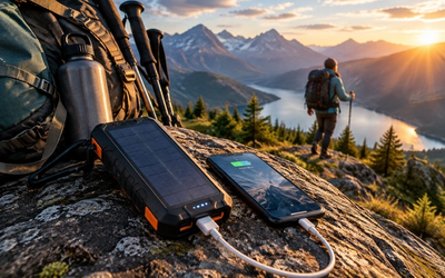
Battery Conservation Strategies — GPS drains batteries faster than any other phone function except video streaming. Enable airplane mode to stop your phone from burning power searching for nonexistent cell towers. Dim your screen, close background apps, and consider a battery bank for multi-day trips. For solar charging options that pair perfectly with extended GPS use, check our Best Solar Power Banks for Backpacking 2026: Tested in Real Trail Conditions guide.
Offline Functionality Limits — Gaia works beautifully offline for viewing maps, following routes, and recording tracks. What doesn't work: live weather overlays, searching for new points of interest, uploading tracks to the cloud, or accessing community-contributed routes. Download or cache everything you need before you hit the trail.
Weather Awareness — While Gaia handles navigation, it won't give you storm warnings offline. Pair it with a dedicated weather radio for NOAA alerts in the backcountry — our Best Weather Radios for Camping 2026: NOAA Alerts Without Cell Service guide covers reliable options that don't depend on cell service.
Step-by-Step: Downloading Maps for Offline Use
1. Choose Your Map Layer
Open Gaia GPS and tap the map layer icon (overlapping squares) in the top right. For offline hiking, we recommend starting with Gaia Topo — it's optimized for mobile screens, shows trails clearly, and includes contour lines. If you need more detailed terrain analysis, add USGS Topo as a second layer. Satellite imagery looks impressive but eats storage fast; skip it unless you're navigating off-trail in featureless terrain.
💡 Pro Tip: National Geographic Trails Illustrated maps are excellent for popular hiking areas and include points of interest that other layers miss.
2. Define Your Download Area
Tap the download icon (downward arrow with a box) and select "Download Map Area." You have two options:
- Rectangle Select: Drag a box around your hiking area. This is fastest but downloads unnecessary sections if your trail follows a narrow corridor.
- Route Buffer: If you've already created a route, select it and choose "Download Route Buffer." Gaia automatically downloads a strip along your planned path with customizable width (we use 2-5 miles depending on terrain complexity).
Always download a larger area than your exact route. Trails get washed out, wildfires close sections, and you might need to detour. We typically download 20-30% more area than our planned route covers.
3. Select Zoom Levels
This is where storage management matters. Each zoom level roughly doubles the required storage:
- Zoom 10-12: Good for overview planning, shows major trails and landmarks (50-200 MB for a typical weekend hike area)
- Zoom 13-15: Ideal for on-trail navigation, readable contour lines (200-500 MB)
- Zoom 16-18: Extreme detail, usually overkill for hiking (1-3 GB)
For a typical 3-day backpacking loop, downloading zoom levels 11-15 of Gaia Topo uses about 300-400 MB. That's manageable even on a 64GB phone. Going to zoom 18 balloons it to 2+ GB.
💡 Pro Tip: Download over Wi-Fi at home, not over cellular data. A weekend trip's worth of maps can easily consume 500MB-1GB, and spotty trailhead LTE makes downloads painfully slow or incomplete.
4. Verify Your Download
Before you leave home, enable airplane mode and open Gaia GPS. Pan around your entire route area and zoom in to trail-level detail. You should see crisp maps with no gray "loading" tiles. If you see gaps, disable airplane mode, return to the download screen, and grab the missing sections.
We also record a short test track in airplane mode (walk around your yard) to confirm track recording works offline. It sounds paranoid, but discovering a broken setup at the trailhead is worse than spending five minutes testing at home.
Navigating With Gaia GPS Offline
Creating and Following Routes
Before your hike, create a route by tapping the "+" icon and selecting "Plot a Route." Tap waypoints along your planned trail to build the route. Gaia snaps to trails automatically if you're zoomed in enough. Save the route with a descriptive name ("Day 1: Bear Lake to Fern Lake" beats "Route 7").
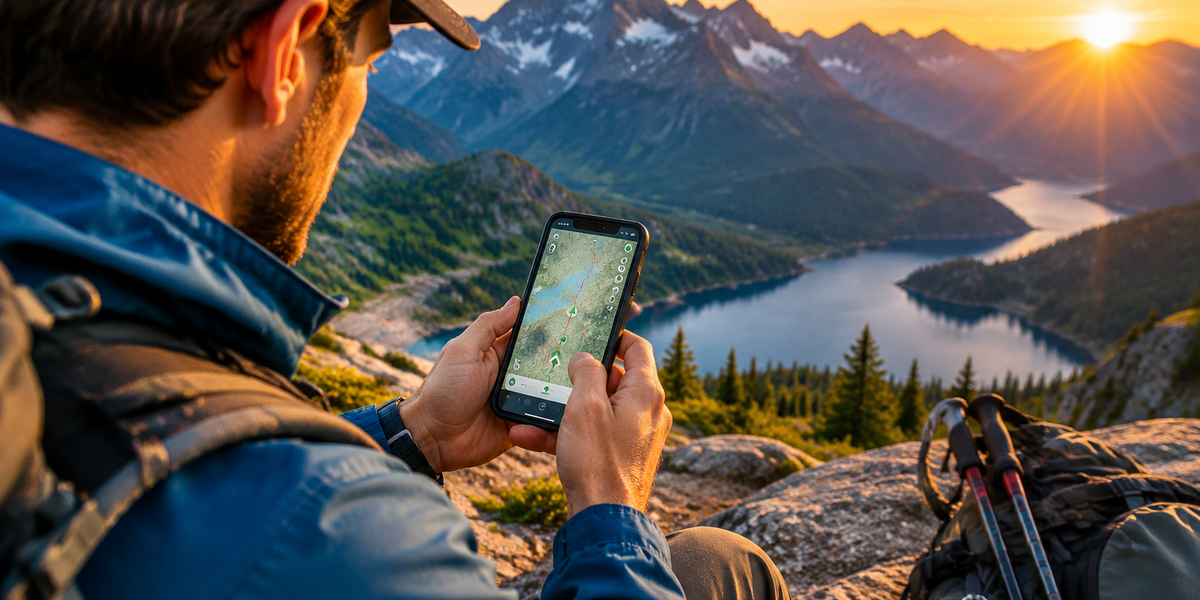
On the trail, open your saved route and tap "Navigate." Gaia displays a blue line showing your planned path and a purple dot showing your current location. The purple dot updates in real time even in airplane mode — GPS satellites work everywhere, cell towers are irrelevant.
The route stats screen shows distance remaining, elevation gain/loss, and estimated time. Take the time estimate with a grain of salt; Gaia doesn't know about your fitness level, pack weight, or terrain difficulty.
Recording Your Track
Tap the red record button before you start hiking. Gaia logs your actual path as a breadcrumb trail, which serves two critical purposes:
- Retracing your steps: If you need to backtrack or got slightly off-route, your recorded track shows exactly where you've been.
- Post-trip analysis: Upload the track later to see your actual mileage, elevation gain, and moving vs. stopped time.
Recorded tracks consume minimal storage (a full day of hiking generates 1-2 MB) and negligible battery. Keep it running.
Waypoint Navigation
Waypoints are single-point markers for critical locations: trailheads, campsites, water sources, food caches. Create them by long-pressing the map or tapping the "+" icon and selecting "Add a Waypoint."
Give each waypoint a clear name and optional note ("Spring — last reliable water for 8 miles"). You can navigate directly to any waypoint, and Gaia shows distance and bearing.
💡 Pro Tip: Screenshot your route map before losing signal. If Gaia crashes or your phone glitches, you'll have a backup image in your photo library.
Battery Management for Multi-Day Trips
GPS is power-hungry. Here's how we routinely get 8-10 hours of active navigation from a single charge:
Enable Airplane Mode: Your phone burns enormous power searching for cell towers that don't exist in the wilderness. Airplane mode stops this battery drain. GPS works independently of cellular — satellites reach everywhere.
Reduce Screen Brightness: Drop it to 30-40%. You don't need full brightness under tree cover, and your battery will thank you.
Close Background Apps: Swipe away everything except Gaia. Email syncing, social media, and news apps are vampires even when you're not using them.
Use Screen Lock Smartly: When you're on an obvious trail with good visibility, lock your screen and check it every 15-20 minutes rather than leaving it on constantly. At trail junctions or during off-trail navigation, keep it active.
Carry a Power Bank: For trips longer than a day, pack a 10,000+ mAh battery bank. We prefer the Anker PowerCore series for their reliability and fast charging. A 20,000 mAh bank gives you 4-5 full phone charges, enough for a week of navigation.
Cold Weather Considerations: Lithium batteries drain faster in cold temps. Keep your phone in an inside jacket pocket when not actively navigating, and keep your power bank insulated too.
For longer backpacking trips where you need easy access to your phone and power management gear, the Osprey Atmos AG 65 Backpacking Pack features an integrated phone pocket with charging port access, letting you top up your device from a power bank without digging through your main compartment. The Anti-Gravity suspension system is a bonus when you're carrying navigation electronics plus days of food and gear.
Troubleshooting Common Offline Issues
Gray Tiles or Missing Map Sections
If you see gray squares instead of maps, you didn't download that area or zoom level. Unfortunately, there's no fix mid-trail. This is why we obsessively verify downloads at home in airplane mode.
If it happens anyway, zoom out to a level you did download. You'll lose detail but maintain situational awareness.
GPS Signal Lost or Inaccurate
Dense tree cover, narrow canyons, and overhangs can block GPS satellites. If your purple location dot disappears or jumps around, move to open terrain. Hilltops and meadows give the clearest signal.
Gaia uses both GPS and GLONASS satellites (Russian GPS equivalent), which improves accuracy, but even the best system needs a clear view of the sky.
Phone Overheating
Running GPS continuously in hot weather can overheat your phone, especially in direct sunlight. If you get an overheating warning, close Gaia, lock your screen, and put the phone in shade (inside your pack). Let it cool for 10-15 minutes before resuming.
App Crashes or Freezes
Rare but frustrating. Force-quit Gaia and restart it. Your recorded track auto-saves every few minutes, so you'll only lose a short segment. This is another reason to screenshot your route map as a backup.
Frequently Asked Questions
Does Gaia GPS work without cell service?
Yes, completely. GPS satellites broadcast signals globally and don't require cell towers. As long as you've downloaded maps beforehand, Gaia navigates, tracks, and shows your location anywhere on Earth. Airplane mode actually improves battery life by stopping your phone from searching for nonexistent cellular signal.
How much storage do offline maps use?
It depends on area size and zoom levels. A typical weekend backpacking trip (20-30 mile loop) downloading Gaia Topo at zoom levels 11-15 consumes 300-500 MB. Satellite imagery or extreme zoom levels (16-18) can balloon this to multiple gigabytes. We recommend keeping 5-10 GB free on your phone for map storage plus photos and other trip data.
Can I record my track in airplane mode?
Absolutely. Track recording logs your GPS position over time and doesn't require internet. Enable airplane mode before starting your hike, then hit the red record button. Your track saves locally and syncs to Gaia's cloud when you regain internet later.
What's the difference between Gaia GPS and other hiking apps?
Gaia excels at offline capability and map layer variety. AllTrails has a larger community and trail reviews, but Gaia's offline maps are more robust. CalTopo offers better route planning tools for serious navigators but has a steeper learning curve. For pure offline backcountry use, Gaia hits the best balance of power and usability.
Do I need a Gaia GPS premium subscription?
The free version lets you download maps and navigate offline, but limits you to one downloaded map area at a time and fewer map layer options. Premium ($39.99/year) unlocks unlimited downloads, additional map layers (USGS, Nat Geo, weather overlays), and cloud sync. For serious hikers doing multiple trips per year, Premium pays for itself in convenience and safety.
Final Thoughts
Gaia GPS transforms your smartphone into a legitimate backcountry navigation tool — if you prepare correctly. The difference between confident navigation and staring at gray tiles comes down to 20 minutes of prep work at home: downloading the right maps, creating waypoints, and verifying everything in airplane mode before you drive to the trailhead.
We've navigated everything from maintained National Park trails to cross-country Sierra passes using nothing but Gaia GPS offline. The technology works. What fails is human preparation.
Before your next hike, spend those 20 minutes. Download maps over Wi-Fi at zoom levels 11-15. Create waypoints for trailheads, campsites, and bailout points. Record a test track in airplane mode to confirm everything works. Pack a power bank. Your future self, three miles past the last cell tower, will thank you.
For day hikes where you need quick phone access for navigation checks, the Osprey Talon 22 Hiking Daypack keeps your device secure and accessible in its integrated hydration sleeve pocket, which doubles perfectly as a phone compartment.
Editor's Choice
Osprey Atmos AG 65 Backpacking Pack — Premium comfort and integrated phone pocket with charging access make this ideal for multi-day backcountry trips where GPS navigation and power management are critical.
Osprey Talon 22 Hiking Daypack — Lightweight daypack with hydration sleeve that doubles as a perfect GPS-accessible phone pocket for day hikes and peak bagging missions.
Anker PowerCore 20000 — Reliable high-capacity battery bank that delivers 4-5 full phone charges for extended GPS use on multi-day wilderness trips without electrical access.