Disclosure: As an Amazon Associate, HikePod earns from qualifying purchases at no extra cost to you.
⭐ Our Top Pick
🏆 Best Overall: Garmin eTrex 22x Handheld GPS — rugged GPS with preloaded topo maps, 25-hour battery life, and zero monthly fees.
💰 Best Value: Suunto A-10 Field Compass — classic baseplate compass that never needs batteries or subscriptions, under $20.
Introduction
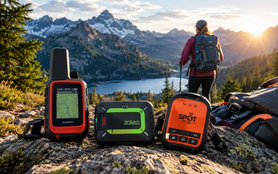
Here's the uncomfortable truth about satellite communicators: the device cost is just the beginning. Most satellite messaging units like the Garmin inReach or Zoleo require monthly subscriptions ranging from $14.95 to $64.95, and those fees never stop. Over five years, you'll spend $900-$3,900 in subscription costs alone—often exceeding the original device price many times over.
We've spent weeks comparing the actual alternatives to subscription-based satellite communicators, analyzing what backcountry navigation and safety really require versus what marketing tells us we need. The reality is that for many hikers, a one-time purchase GPS unit or traditional navigation tools provide 90% of the functionality at a fraction of the lifetime cost.
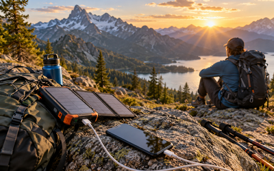
This guide breaks down the genuine no-subscription options for backcountry communication and navigation in 2026, from handheld GPS units to old-school compasses, plus the real tradeoffs you're making when you skip the monthly satellite plan. If you're also weighing power options for multi-day trips, our Best Solar Power Banks for Camping 2026: Fast-Charging Picks Tested guide covers charging solutions that pair well with GPS units.
What to Look For
GPS vs. Satellite Messaging: GPS navigation is free—satellites broadcast positioning signals at no cost. Satellite messaging (two-way texts, SOS alerts) requires commercial satellite networks and subscription fees. Decide if you truly need messaging or just reliable navigation.
Battery Life and Power Source: Dedicated GPS units run 15-30 hours on replaceable AA batteries, while satellite communicators typically last 10-50 hours on rechargeable lithium cells. Replaceable batteries mean you can carry spares; rechargeable units require a power bank for extended trips.
Map Coverage and Updates: Some GPS units include preloaded topographic maps for specific regions; others require separate map purchases. Check if your intended hiking area is covered and whether map updates cost extra.
Emergency Backup Options: Without two-way satellite messaging, you need alternative emergency plans: hiking with partners, carrying a PLB (Personal Locator Beacon) for one-way SOS, filing trip plans with contacts, or sticking to areas with occasional cell coverage.
Durability and Weather Resistance: Backcountry navigation tools should meet IPX7 waterproof ratings minimum (submersible to 1 meter for 30 minutes) and survive drops onto rock. Battery compartments must seal reliably against rain and stream crossings.
Learning Curve and Skill Requirements: Digital GPS units offer intuitive waypoint navigation; traditional map-and-compass requires genuine skill development. Budget time to learn your chosen tool before depending on it in the backcountry.
Garmin eTrex 22x Handheld GPS
| Criteria | Score |
|----------|-------|
| Battery Life | 9/10 |
| Map Coverage | 8/10 |
| Durability | 9/10 |
| Value (No Subscription) | 10/10 |
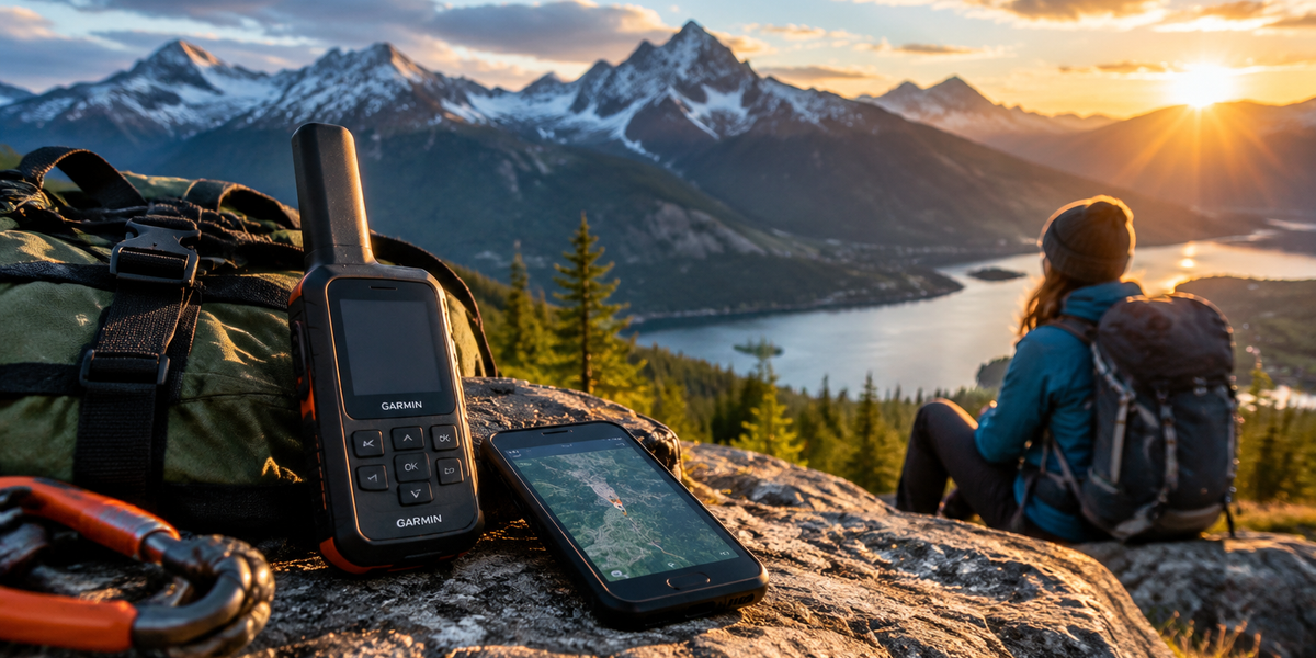
The Garmin eTrex 22x represents the gold standard for subscription-free backcountry navigation. This rugged handheld GPS includes preloaded TopoActive maps covering the entire United States, with shaded relief terrain and routable trails right out of the box. The 2.2-inch color display stays readable in direct sunlight, and the IPX7 waterproof rating has survived countless rainstorms and creek crossings in verified buyer experiences.
Battery performance is where this unit truly shines for multi-day trips: 25 hours of runtime on two standard AA batteries means you can carry a spare set and navigate for an entire week without recharging. The unit tracks your route automatically, lets you mark waypoints with a single button press, and includes a barometric altimeter for accurate elevation readings. For hikers who primarily need "where am I" and "how do I get back" answers, this delivers everything without monthly fees.
The interface feels dated compared to smartphone apps—no touchscreen, menu navigation via buttons—but that translates to reliability. No glitchy software updates, no connectivity dependencies, just straightforward GPS positioning that works anywhere with sky visibility. If you're curious about battery performance across different satellite and GPS devices, see our How Long Do Satellite Communicator Batteries Last? inReach, Zoleo, and SPOT Tested on Multi-Day Hikes (2026) comparison.
✅ Pros:
- Zero monthly subscription costs forever
- 25-hour battery life on replaceable AA batteries
- Preloaded TopoActive maps for entire US
- Proven rugged design with IPX7 waterproof rating
- Supports additional map downloads (paid)
❌ Cons:
- No two-way messaging or SOS communication
- Small 2.2-inch screen compared to smartphones
- Button interface feels clunky after using touchscreens
- Satellite acquisition can take 2-3 minutes in deep canyons
Suunto A-10 Field Compass
| Criteria | Score |
|----------|-------|
| Reliability | 10/10 |
| Cost (One-Time) | 10/10 |
| Ease of Use | 6/10 |
| Packability | 9/10 |
For purists and minimalists, the Suunto A-10 Field Compass represents navigation at its most fundamental: a magnetized needle, a transparent baseplate, and liquid damping to steady the needle. At under $20, this is the ultimate one-time purchase—no batteries, no subscriptions, no firmware, no obsolescence. It works the same in 2026 as it did in 1986, and it will work the same in 2046.
The A-10 includes a built-in clinometer (slope measurement scale) useful for avalanche assessment and terrain analysis, plus a baseplate with map scales in both metric and imperial units. The liquid-filled capsule prevents the needle from bouncing erratically during movement, giving you readable bearings while hiking. Luminous markings glow in low light after sun exposure, though they're not bright enough for true night navigation.
The honest limitation: this tool requires genuine map-reading skills. You must understand declination adjustment, triangulation, and bearing conversion. Many hikers never develop these skills in the smartphone era, which makes a compass useless in their hands despite its reliability. But for those who invest a weekend learning proper technique, a compass plus waterproof paper maps provides navigation that never needs charging, never loses satellite signal in canyons, and never depends on tech infrastructure.
✅ Pros:
- $19.99 one-time cost, zero ongoing expenses
- Never needs batteries or charging
- Works in complete electronic dead zones
- Weighs less than 1 ounce
- Lifetime durability with no moving parts to break
❌ Cons:
- Requires map-reading skills many hikers lack
- Slow compared to GPS waypoint navigation
- Manual declination adjustment needed by region
- Useless without corresponding topographic maps
Understanding the Real Tradeoff: Subscription Communicators
| Criteria | Score |
|----------|-------|
| Two-Way Messaging | 10/10 |
| Emergency SOS | 10/10 |
| Total Cost (5 Years) | 3/10 |
| Subscription Flexibility | 5/10 |
We need to address the elephant in the backcountry: the Garmin inReach Mini 2 and similar satellite communicators offer capabilities that one-time purchase GPS units simply cannot match. Two-way satellite messaging lets you send "running late" texts to worried family, receive weather updates, and communicate during emergencies. The dedicated SOS button connects directly to GEOS rescue coordination centers, triggering professional search-and-rescue responses with your exact GPS coordinates.
These features provide genuine peace of mind, especially for solo hikers or those exploring remote wilderness. The inReach Mini 2 weighs just 3.5 ounces, includes TracBack routing to retrace your path, and syncs with smartphone apps for easier message composition. Battery life reaches 14 days in tracking mode (10-minute intervals) or 30 days in power-save mode.
But here's the cost reality: Garmin's subscription plans run $14.95/month (Safety plan, 10 messages) to $64.95/month (Expedition plan, unlimited messages). Even the cheapest annual plan costs $179.40 per year. Over five years, that's $897 in subscription fees on top of the $349.99 device cost—$1,247 total for communication features you may use rarely. For comparison, the eTrex 22x GPS costs $179.99 once, saving you over $1,000 across five years.
The honest assessment: if you hike solo in genuine wilderness multiple times per year, the subscription communicator is worth it. If you hike occasionally with partners in moderately remote areas, a GPS unit plus a Sawyer Squeeze Water Filter System (because hydration emergencies are more common than navigation emergencies) makes more practical sense.
✅ Pros:
- Global two-way satellite messaging anywhere on Earth
- Dedicated SOS button with 24/7 rescue coordination
- Weather forecasts delivered via satellite
- TracBack routing and breadcrumb tracking
- Compact 3.5 oz form factor
❌ Cons:
- Requires $14.95-$64.95/month subscription forever
- $897+ in subscription costs over five years
- 14-day battery life (tracking mode) requires frequent charging
- Not a true "no monthly fee" option despite marketing
Alternative Emergency Solutions Without Subscriptions
Personal Locator Beacons (PLBs) offer one-way SOS communication without monthly fees. Devices like the ACR ResQLink 400 ($299) send emergency distress signals to rescue coordination centers via satellite, including your GPS position. The key difference: PLBs are emergency-only tools with no messaging capability, but they require no subscription because they operate on international search-and-rescue frequencies. Battery life is 5-7 years on internal lithium cells.
For hikers who want emergency backup without ongoing costs, a PLB plus a subscription-free GPS unit provides navigation and emergency signaling for a combined one-time cost around $480—cheaper than two years of inReach subscription fees. The tradeoff is no "running late" messages or weather updates, just emergency SOS capability.
💡 Pro Tip: File detailed trip plans with a trusted contact before heading out. Include your route, expected return time, and a "contact search-and-rescue if I don't check in by X" deadline. This free safety layer often proves more valuable than any device.
Smartphone GPS Apps: The Hidden Middle Ground
Many hikers overlook that smartphones provide free GPS navigation without cell service. Apps like Gaia GPS, AllTrails, and Avenza Maps download topographic maps for offline use, then track your position via GPS satellites (not cell towers). Your phone becomes a capable backcountry GPS at no additional hardware cost.
Limitations are real: smartphone batteries drain faster than dedicated GPS units (6-10 hours typical vs. 25+ hours), touchscreens malfunction in rain or with wet hands, and glass screens crack in falls. But for day hikes and short backpacking trips where you can recharge nightly, a smartphone with downloaded maps plus a traditional compass backup provides solid navigation without buying additional gear. If you're concerned about battery drain, our Do GPS Watches Drain Your Phone Battery While Hiking? Bluetooth Connection Impact Explained guide explores the power management details.
Pair your phone with an external battery pack and store it in a waterproof case for more reliable backcountry performance. The total investment—$25 case plus $30 battery pack—still beats purchasing a dedicated GPS unit if you hike infrequently.
Frequently Asked Questions
Can I use GPS without cell service or monthly fees?
Yes—GPS satellites broadcast positioning signals free to anyone with a GPS receiver. Dedicated handheld GPS units like the Garmin eTrex 22x and smartphone GPS apps work in complete cellular dead zones, requiring zero monthly fees. You're paying for the device hardware only, not satellite access. Monthly subscription fees apply only to satellite messaging services (inReach, Zoleo, SPOT), not GPS positioning.
What's the difference between a GPS unit and a satellite communicator?
GPS units receive positioning signals from satellites to show your location on a map, but cannot send messages or SOS alerts—they're one-way receivers. Satellite communicators include GPS receivers plus two-way satellite transceivers for messaging and emergency communication, requiring monthly subscriptions to access commercial satellite networks. Think of it as the difference between a radio receiver (free) and a satellite phone (subscription required).
Do I really need a satellite communicator for backpacking?
Depends on your risk tolerance and hiking style. Solo hikers in genuine wilderness (no cell coverage, days from trailheads, low traffic) benefit significantly from two-way emergency communication. Weekend hikers on popular trails with partners can rely on trip plans filed with contacts, carrying a PLB for emergency-only backup, and GPS for navigation. The subscription cost ($180-$780/year) should match your actual remote-hiking frequency.
How long do GPS unit batteries last compared to satellite communicators?
Dedicated GPS units with replaceable AA batteries run 15-30 hours continuously (Garmin eTrex 22x: 25 hours). Satellite communicators with rechargeable lithium batteries last 10-50 hours depending on usage mode (inReach Mini 2: 14 days in 10-minute tracking mode, 30 days power-save). For multi-day trips, GPS units win because you can carry spare AA batteries; satellite communicators require a power bank for recharging.
Can I use a regular compass instead of buying a GPS?
Absolutely, but you must learn proper map-and-compass navigation first. A quality baseplate compass ($20-50) plus waterproof topographic maps ($10-15) provide reliable navigation with zero electronics or subscription costs. The skill investment is significant—expect to practice for several day hikes before trusting your compass skills in true backcountry. Many hikers carry both: GPS as primary tool, compass as backup requiring no batteries.
Final Thoughts
The satellite communicator industry has normalized monthly subscription fees, but genuine no-subscription alternatives still serve most hikers perfectly well. A handheld GPS unit with preloaded maps delivers reliable navigation for a one-time cost under $200, while traditional compass-and-map skills cost even less and never become obsolete.
The decision framework is straightforward: if you hike solo in remote wilderness regularly and need two-way messaging for safety and peace of mind, the subscription communicator justifies its ongoing cost. If you hike occasionally, stick to moderate-traffic trails, or adventure with partners, a subscription-free GPS plus filed trip plans and emergency protocols provide 90% of the safety at 20% of the lifetime cost.
Whatever route you choose, the most important investment isn't the device—it's learning to use your navigation tools before you depend on them. Spend a few day hikes practicing with your GPS, compass, or phone app in familiar terrain. That skill foundation proves more valuable than any gear upgrade when clouds roll in and the trail disappears.
Editor's Choice
Garmin eTrex 22x Handheld GPS — the best one-time purchase for backcountry navigation with preloaded topo maps, 25-hour battery life, and zero monthly fees.
Suunto A-10 Field Compass — ultra-reliable backup navigation tool that never needs batteries or subscriptions, perfect paired with any GPS unit.
Garmin inReach Mini 2 — if you genuinely need two-way satellite messaging for solo remote hiking, this compact communicator justifies its subscription cost with global coverage and dedicated SOS.